
Property Mapping: Why It Matters, What to Avoid, and How Pros Actually Do It
December 10, 2025
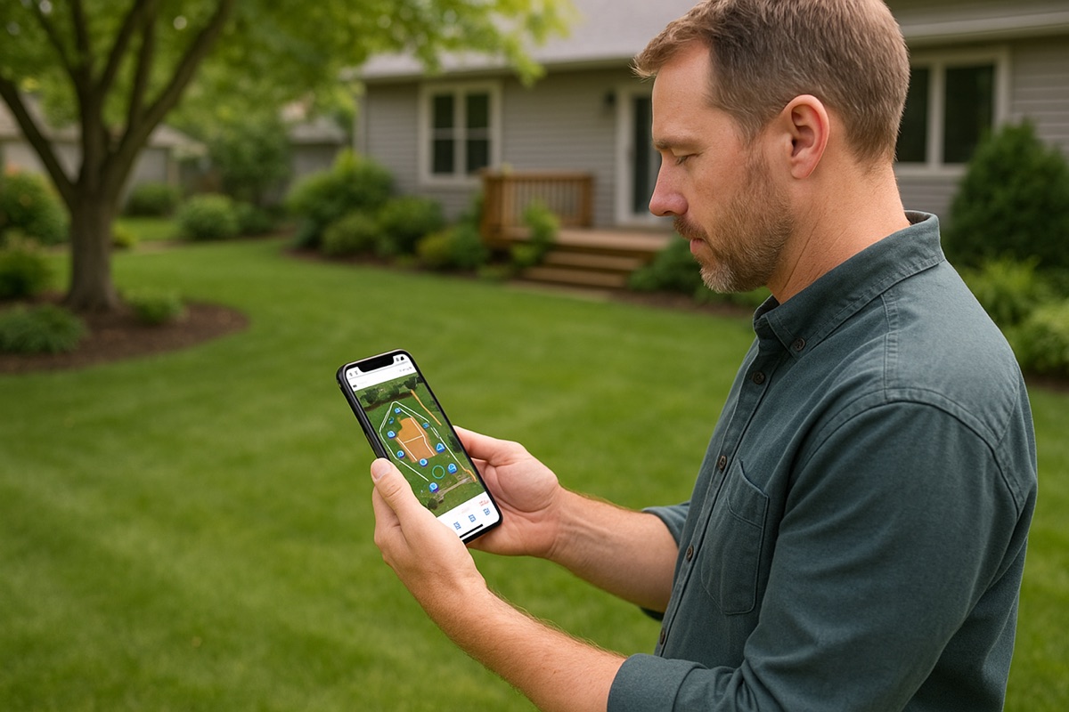
Property mapping sounds simple, until you’re the one outside digging for hours, trying to find a shut-off valve that should be there but isn’t. Whether you’re a homeowner, landscaper, contractor, or managing a large commercial or golf property, accurate property mapping is one of the most valuable (and most overlooked) tools you can invest in.
After mapping hundreds of properties from small residential yards to sprawling estates, golf courses, and municipal sites, I’ve seen the same challenges over and over. And I’ve also seen how the right mapping approach can save people time, money, and a ton of headaches.
Here’s what I’ve learned, what tools actually work, and how you can map your property like a pro.
The Real Problems Caused by Poor or Nonexistent Mapping
Most people only think about mapping after they’ve run into a problem. By then, they’re already frustrated.
Common issues include:
- Spending hours digging and never finding what you’re looking for
- Not being able to locate shut-off valves during an emergency
- Hitting irrigation or utility lines while trenching
- Losing track of drains, sleeves, conduits, and splices
- Having no system for tracking what was installed, when, or by whom
These problems aren’t just annoying, they can be expensive. A single damaged line or missed leak can easily cost hundreds or thousands of dollars.
Real Examples: How Property Mapping Saves Time and Money
Two examples stand out:
1. The Hidden Drain
A client knew he had a drain somewhere in a mulched area, but after several attempts, he still couldn’t find it. Using YardPro, he dropped a GPS pin when he first installed it. Months later, he opened the app, walked right to that exact spot, and uncovered it in seconds. What would’ve taken hours of digging took almost no effort.
2. Buried Conduits Under a Sidewalk
Another client had run conduits under a sidewalk before pouring concrete. Months later, grass and soil had shifted, and the exact spot was impossible to eyeball. Because he had logged the conduits with a GPS pin and photos in YardPro, he found them in minutes, without cutting the wrong section or tearing up the walkway.
These kinds of stories repeat constantly. Mapping doesn’t just make things more organized, it prevents avoidable disasters.
How I Map a Property: My Step-by-Step Workflow
After years of doing this, here’s the process that consistently delivers accurate, reliable results:
1. Start by Adding Irrigation Zones
Zones set the framework. Everything you find later can be tied back to these.
2. Locate the Easy Stuff First
Irrigation heads, valve boxes, shut-off valves, meters, controllers - anything above ground or obvious should be logged first.
3. Run Each Zone and Add Sprinklers
Turn on zones one by one, marking each head as it pops up. This gives you accurate coverage patterns and makes it easy to identify sprinkler heads. It also helps you associate the drip lines to the zones you added in Step 1.
4. Use Aerial Photos When Available
After field work, review aerial images. You’ll often spot lines, trenches, or past patterns you didn’t notice from ground level. You can often go into Google Earth and uncover images done during the build by going back several years.
5. Find the Hard-to-Locate Lines
Dowsing rods are surprisingly effective for tracking underground irrigation lines. They’re old-school, but they work.
6. Update the Map Over Time
Property mapping is not a one-day project. Every time you add, change, repair, or discover something, log it.
This workflow creates a living, evolving map, not a one-time drawing that becomes outdated.
The Tools That Actually Make Mapping Easier
People overcomplicate this. You only need a few tools to create a highly accurate property map:
- Bluetooth GPS Unit (for precise pin placement)
- Dowsing Rods (for finding underground irrigation lines)
- Basic Metal Detector (for locating buried valves or boxes)
With these tools alone, mapping becomes dramatically simpler and far more reliable.
Common Mistakes That Make Maps Useless Later
Here are the biggest errors I see:
1. Only Taking Close-Up Photos
A close-up of a valve box is worthless without context.
Always take wide shots so you can see landmarks and orientation so that you can more easily find that item in the future.
2. Not Adding Notes
Future you (or your crew) won’t remember every detail. Notes save enormous time later.
3. Trying to Map Everything in One Day
Mapping is iterative, especially on large properties. Don’t burn out, build it over time.
Why We Added Task Management to YardPro
One thing became clear quickly:
A map is just the foundation.
After mapping hundreds of properties, I realized professionals also needed a way to manage:
- recurring maintenance
- filter changes
- system checks
- seasonal tasks
- crew assignments
That’s why YardPro now includes a full task-management system on top of the mapping platform.
The map answers “Where is it?”
Task management answers “What needs to be done next?”
Accurate Maps Make Repairs Faster and Cheaper
When someone comes out for a repair, the hardest part is finding the root issue.
The actual fix is often simple, but only after you locate it.
A precise map eliminates the search phase.
And if you ever buy or sell a property, a mapped irrigation system should be part of the handover. It’s as important as documenting appliances or providing a home inspection report.
How Sensors Changed the Future of Property Mapping
People kept asking me:
“Can you tell me when something is wrong?”
That’s where sensors come in.
Small leaks on drip lines can go unnoticed for months. They’re nearly impossible to find manually and they waste huge amounts of water. YardPro’s leak detection sensors now detect leaks automatically and alert you instantly.
Every drip system will eventually leak.
A map helps you find where things should be.
A sensor tells you when something isn’t right.
Together, they transform property management from reactive guesswork into proactive oversight.
The Bottom Line
Property mapping isn’t just a nice-to-have. It’s a foundational part of maintaining any landscape, irrigation system, or large property efficiently.
With the right process and the right tools, and by using technology like GPS mapping, layers, photos, notes, and sensors, you can save hours of labor, prevent costly mistakes, and keep every asset on your property visible and easy to locate.
If you want to start mapping your own property or manage multiple sites professionally, you can explore how YardPro works here: